
Updated Tuesday, September 15, 2026, at 9:15 AM
Sunny and Warm Tuesday and Wednesday
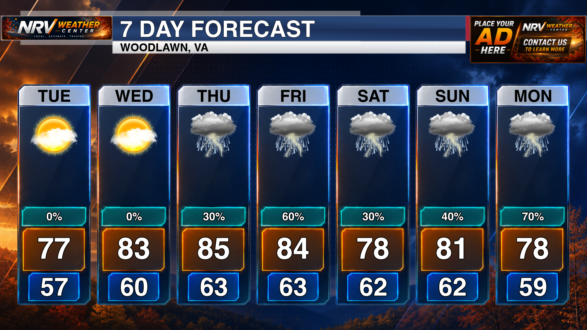
Sunshine and warm temperatures will remain the main weather story across the region today and Wednesday. Most locations will stay dry, making both days favorable for outdoor plans.
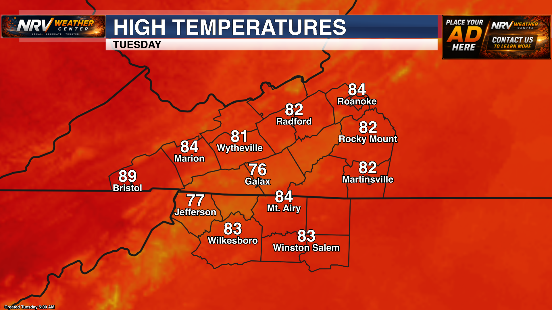
Temperatures will continue their gradual warming trend today across the New River Valley, Roanoke Valley, Southside Virginia, Northern North Carolina, the North Carolina Mountains and the North Carolina Piedmont.
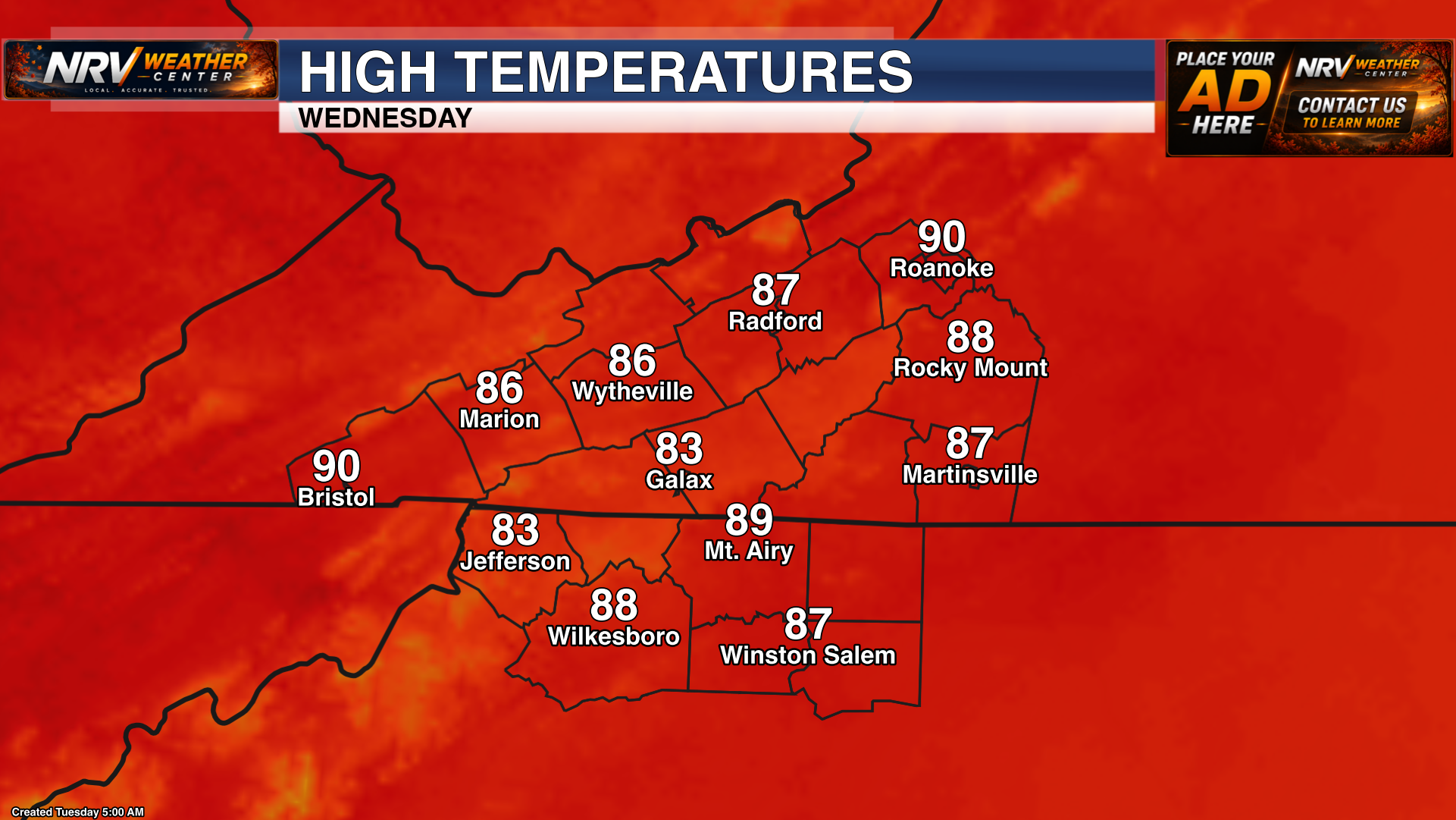
Wednesday will bring another sunny and warm afternoon, with temperatures climbing a little higher in many locations. Clouds may begin to increase later Wednesday or Wednesday night as moisture slowly returns.
Isolated Rain and Storm Chances Return
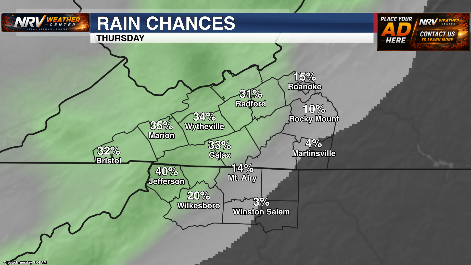
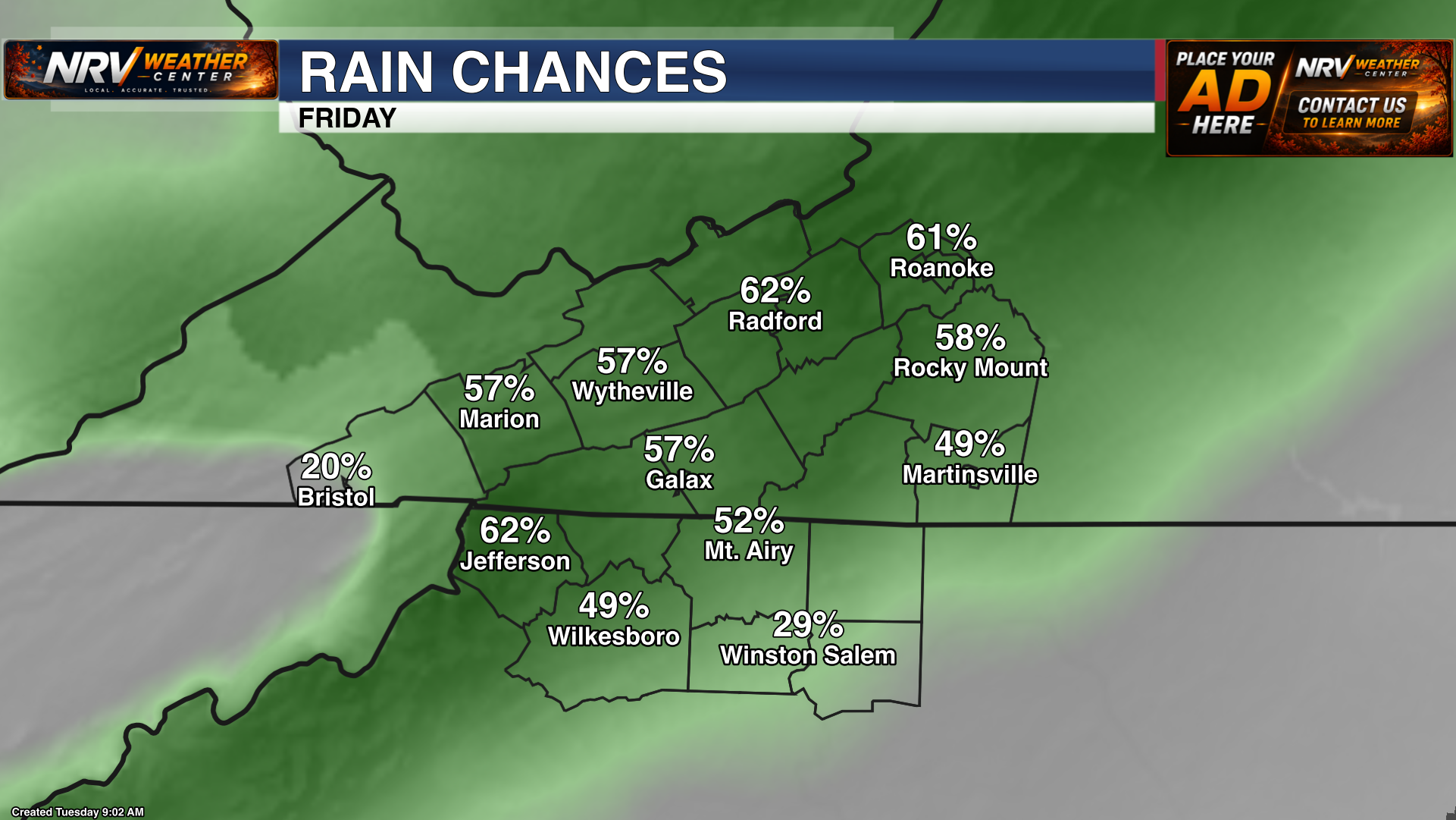
The pattern becomes slightly more unsettled Thursday and Friday as moisture increases. Isolated showers and thunderstorms will be possible both afternoons, but this does not look like an all-day rain for the entire region. Many locations may remain dry, while areas that do receive a storm could pick up a brief period of locally heavier rainfall.
Temperatures will remain warm through the end of the workweek. We will continue to refine the timing and coverage of the late-week rain chances as newer forecast information becomes available.
Rainfall Deficit Continues to Grow
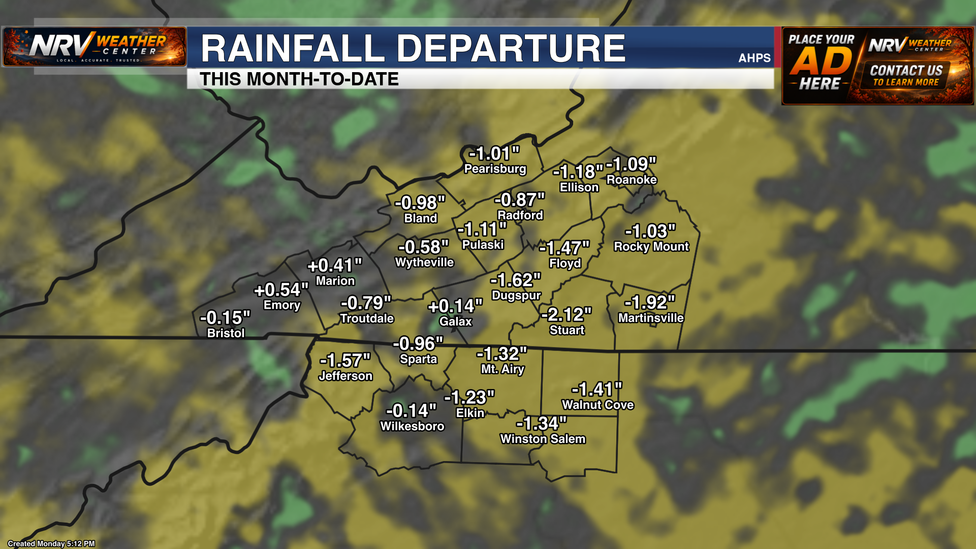
Rainfall observations show that much of the region is running around 1 to 2 inches below normal so far this month. The isolated nature of Thursday and Friday's rain chances means rainfall totals may vary considerably over short distances, and the expected activity may not be enough to erase the developing deficit everywhere.
Watching a Tropical Wave
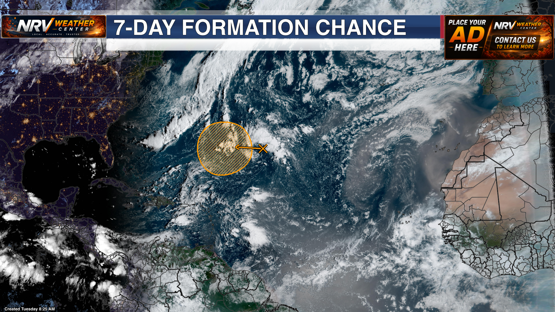
In the tropics, a tropical wave is being monitored for possible development later this week. It remains too early to determine whether the system will organize or where it may eventually track.
There is no immediate tropical threat to our region. This is simply a system to watch over the coming days, and we will provide updates if development occurs or the forecast becomes more relevant to the United States.
Follow NRV Weather Center on Facebook and visit www.nrvweather.com for the latest local weather information.