Updated Monday, September 14, 2026, at 9:15 AM
Quiet, Warm Weather Continues Through Wednesday
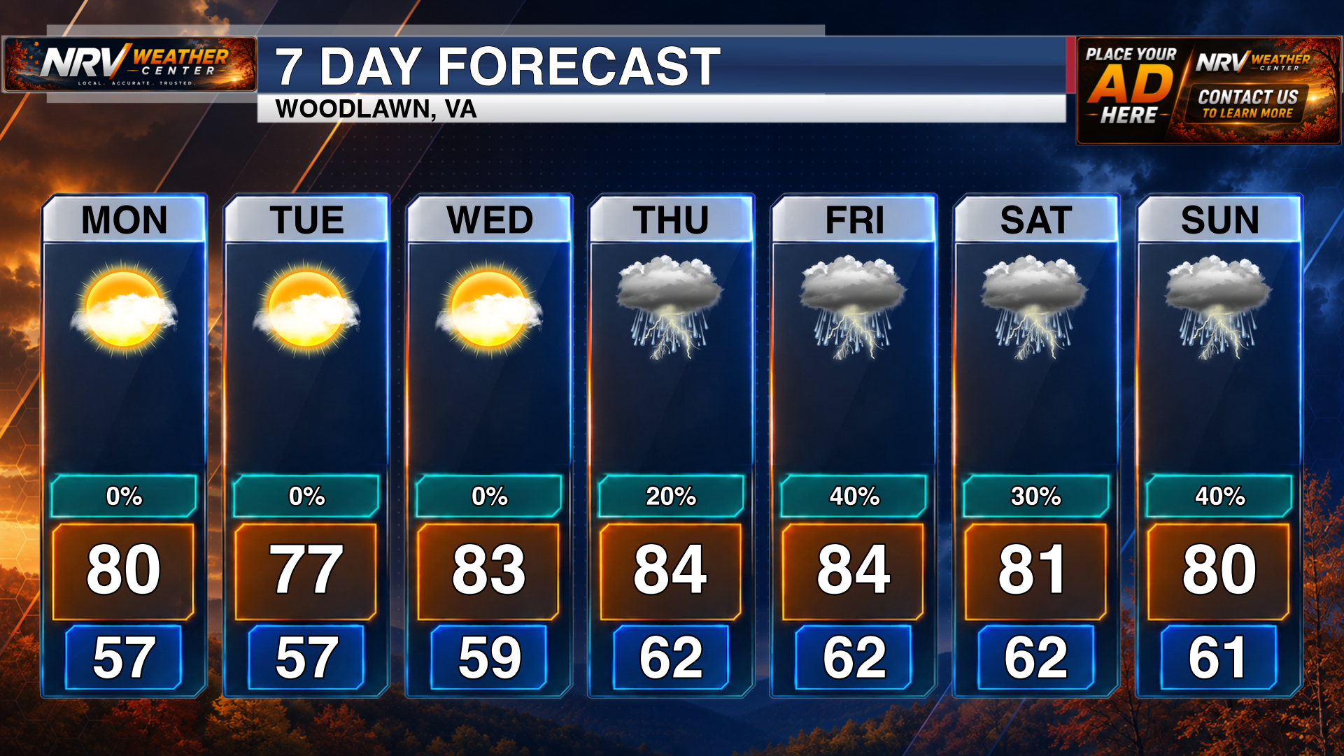
A quiet stretch of weather will continue across the region through the middle of the week. Sunny skies and warm afternoon temperatures are expected today, Tuesday and Wednesday, providing several favorable days for outdoor activities and travel.
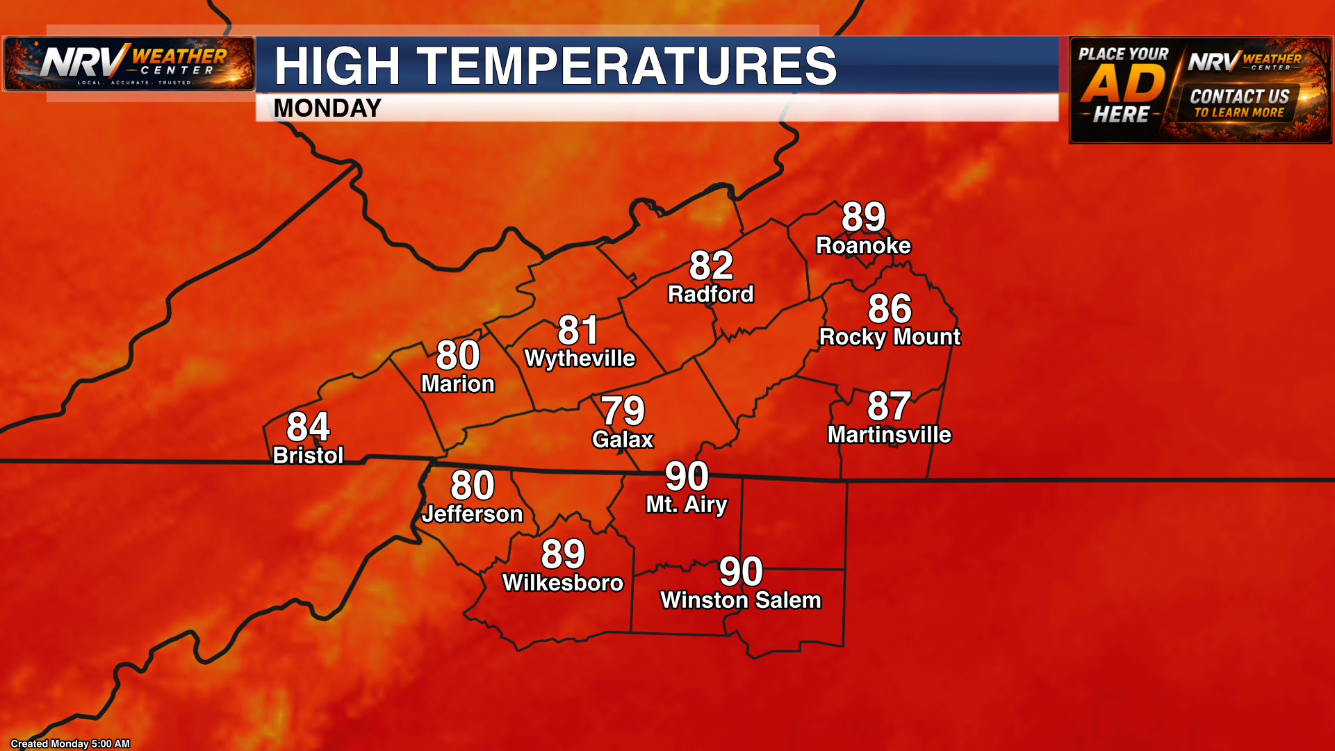
Today will feature plenty of sunshine across the New River Valley, Roanoke Valley, Southside Virginia, Northern North Carolina, the North Carolina Mountains and the North Carolina Piedmont. With little to no precipitation expected, the main weather story will be the warm afternoon temperatures.
More Sunshine Tuesday and Wednesday
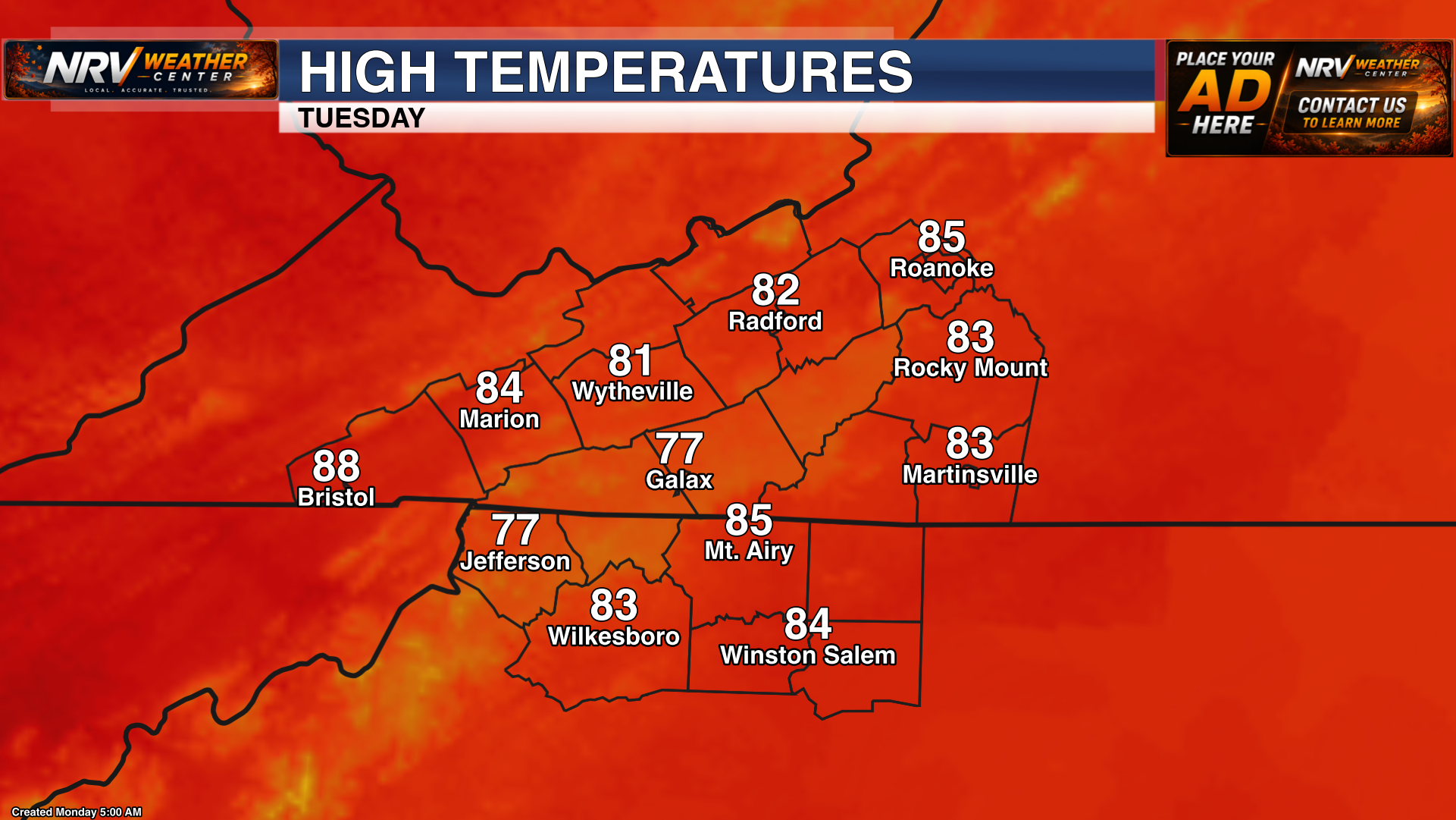
The sunny and warm pattern will hold through Tuesday, with another dry day expected across the region. Temperatures will remain warm during the afternoon, while mornings and nights should continue to feel more comfortable.
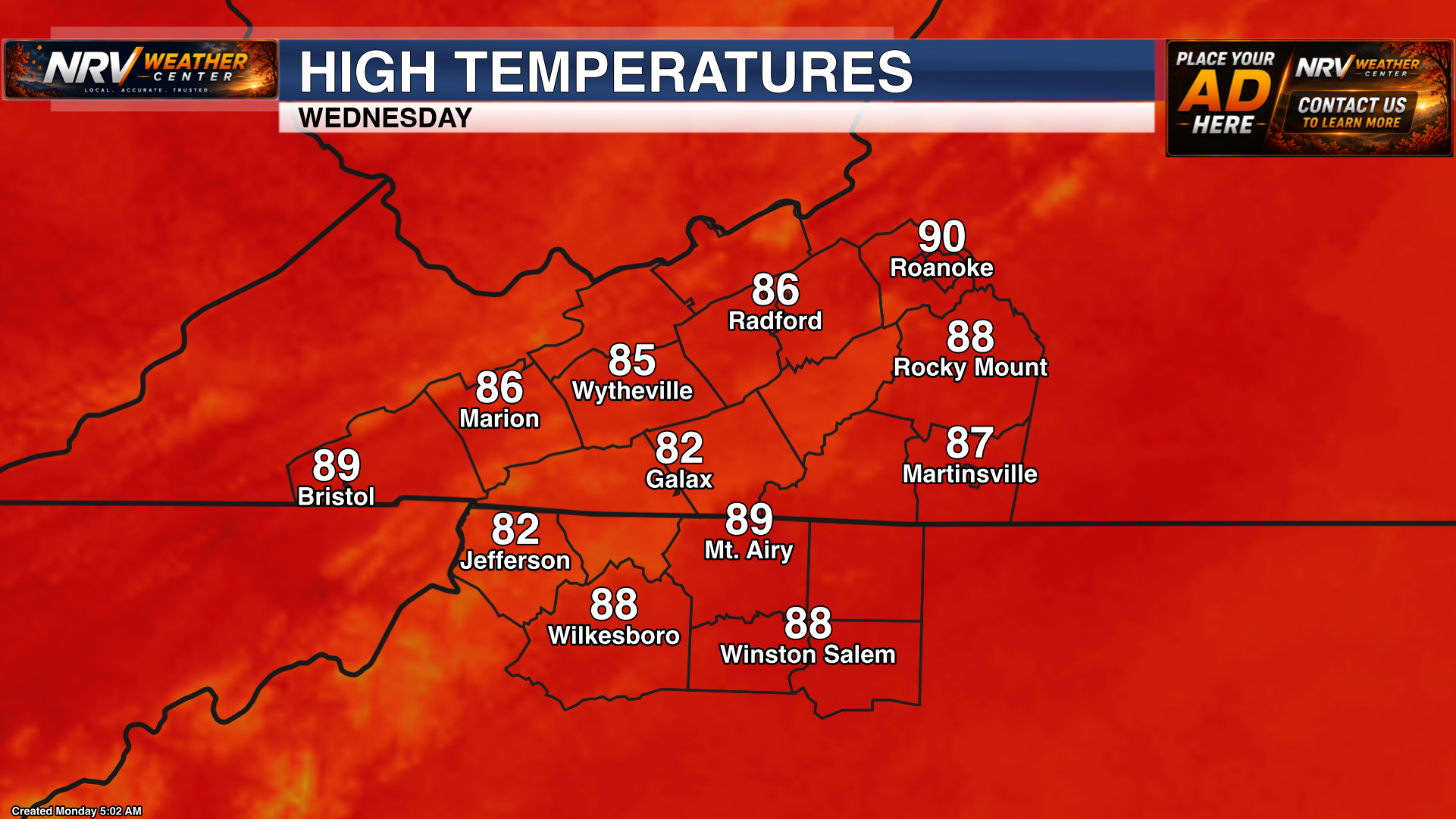
Wednesday will bring one more mostly sunny and warm day before the overall weather pattern begins to change. Clouds may gradually increase later in the day or Wednesday night as moisture starts returning to the region.
Precipitation Chances Increase Thursday
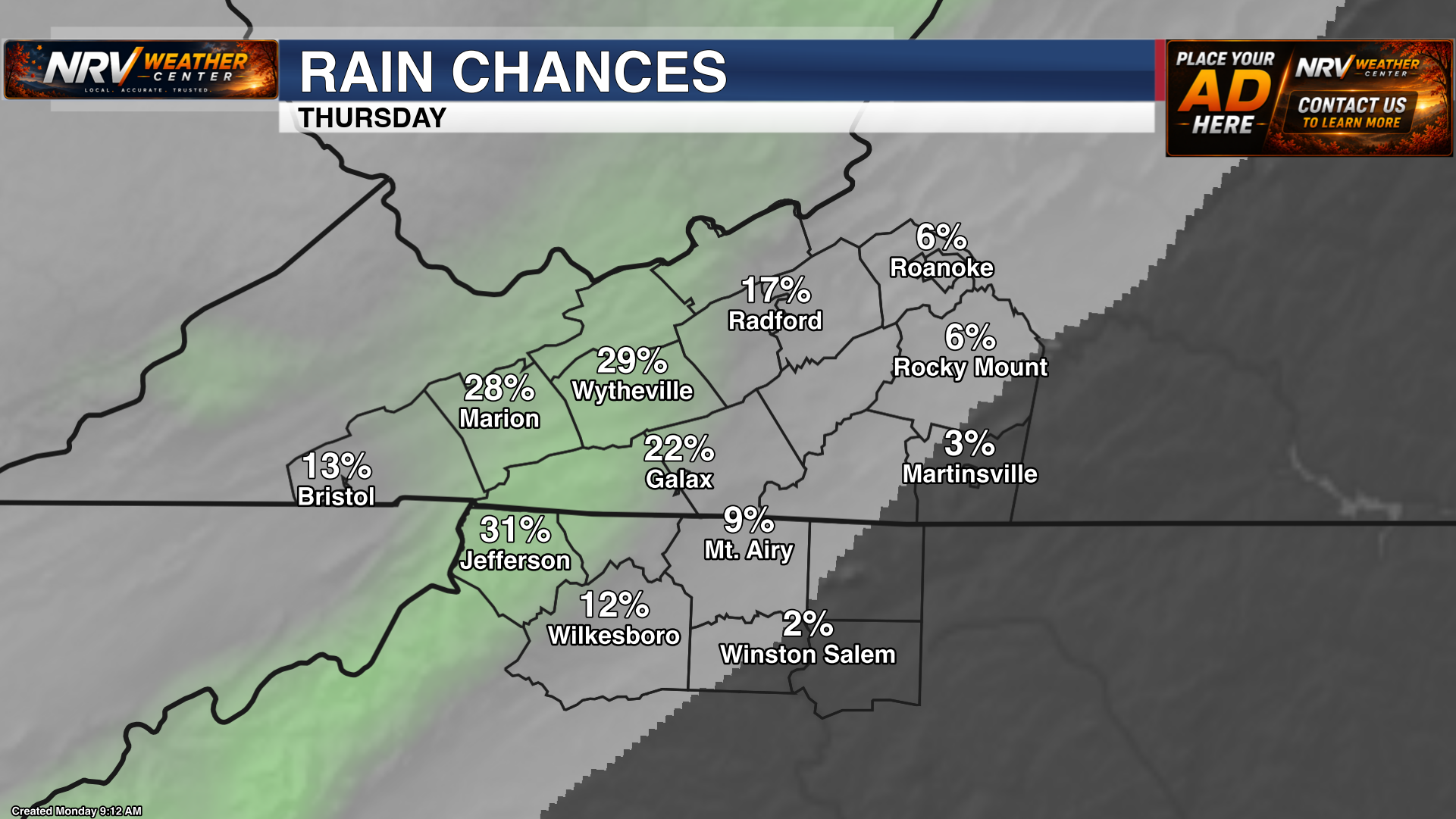
The stretch of dry weather is expected to come to an end by Thursday. Moisture will increase across the region, bringing a greater chance for showers and possibly a few thunderstorms. Rain is not expected to fall continuously everywhere, but outdoor plans will become more weather-dependent beginning Thursday.
Unsettled Pattern Continues Through the Weekend
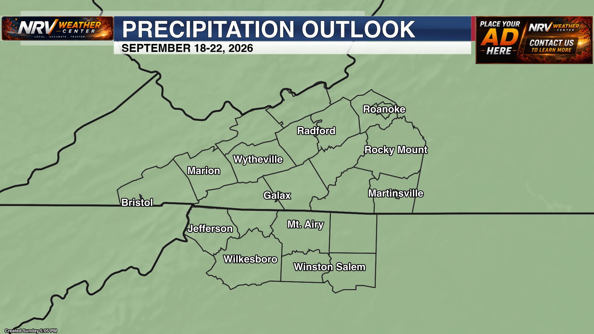
Periodic opportunities for showers and thunderstorms are expected to remain in the forecast from Thursday through the weekend. There may still be dry breaks between rounds of precipitation, but the pattern will be noticeably more unsettled than the sunny weather expected during the first half of the week.
The exact timing and coverage of each round of precipitation will become clearer as the week progresses. Check back with NRV Weather Center for updated forecasts, graphics and any changes that could affect weekend plans.
Follow NRV Weather Center on Facebook and visit www.nrvweather.com for the latest local weather information.