Updated Wednesday, September 16, 2026, at 9:15 AM
Sunny, Warm and Dry Today
Sunshine, warm temperatures and dry conditions will continue across the region today. No meaningful rain is expected, making it another favorable day for outdoor plans across the New River Valley, Roanoke Valley, Southside Virginia, Northern North Carolina, the North Carolina Mountains and the North Carolina Piedmont.
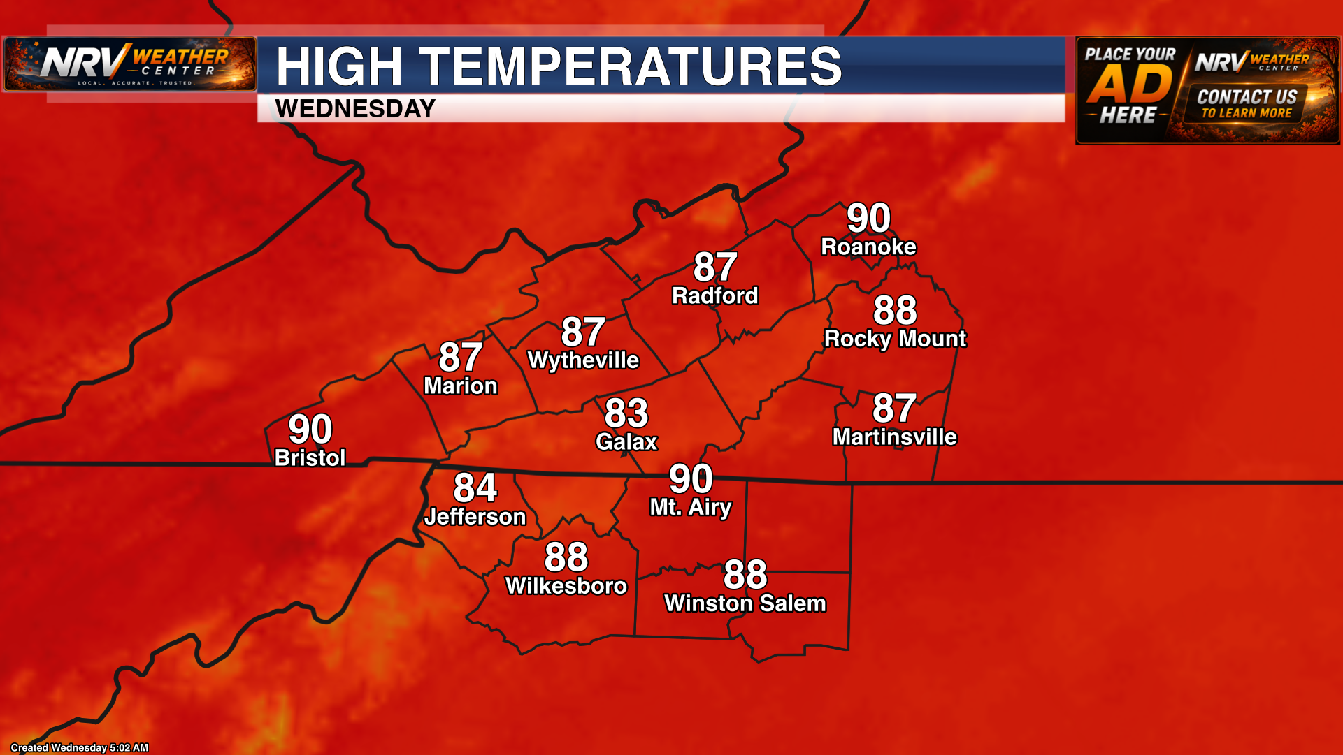
Afternoon temperatures will continue to run warm, with many locations climbing into the 80s. Clouds may begin to increase later today or tonight as additional moisture starts returning to the region.
Scattered Rain and Storm Chances Increase Thursday and Friday
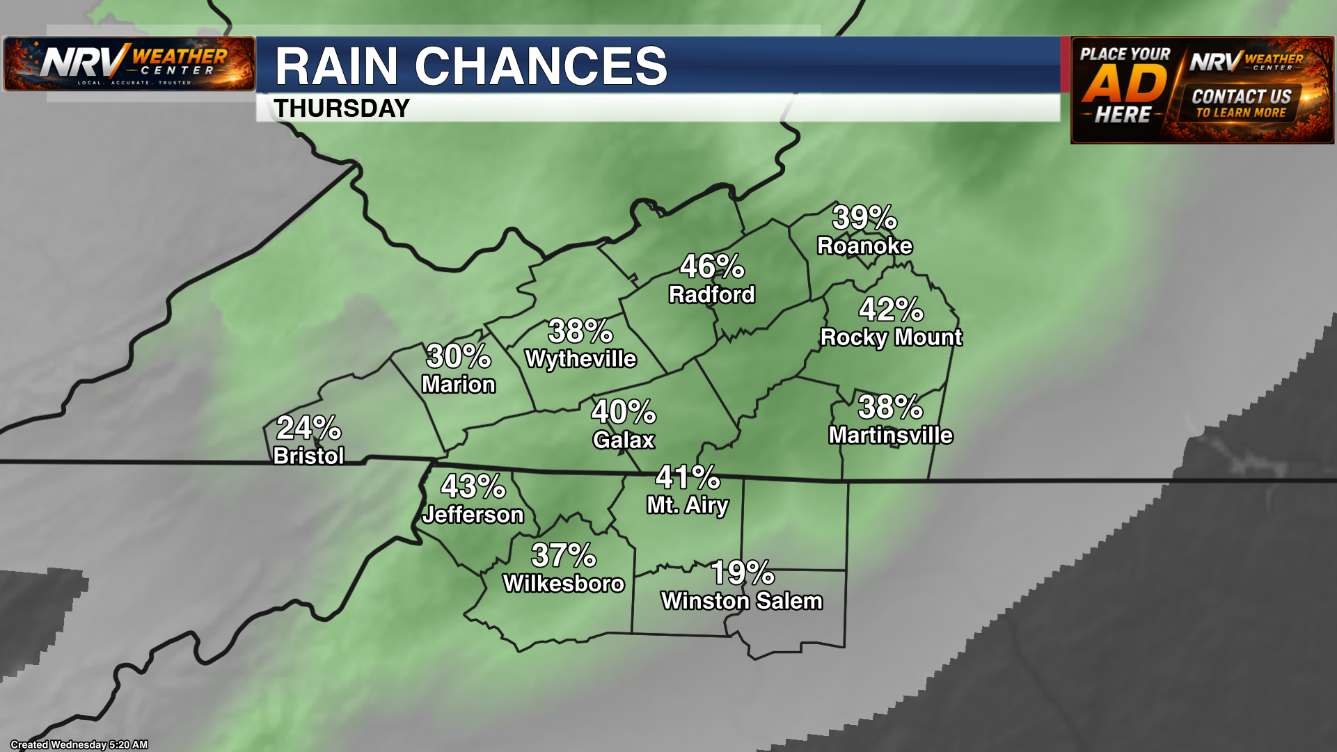
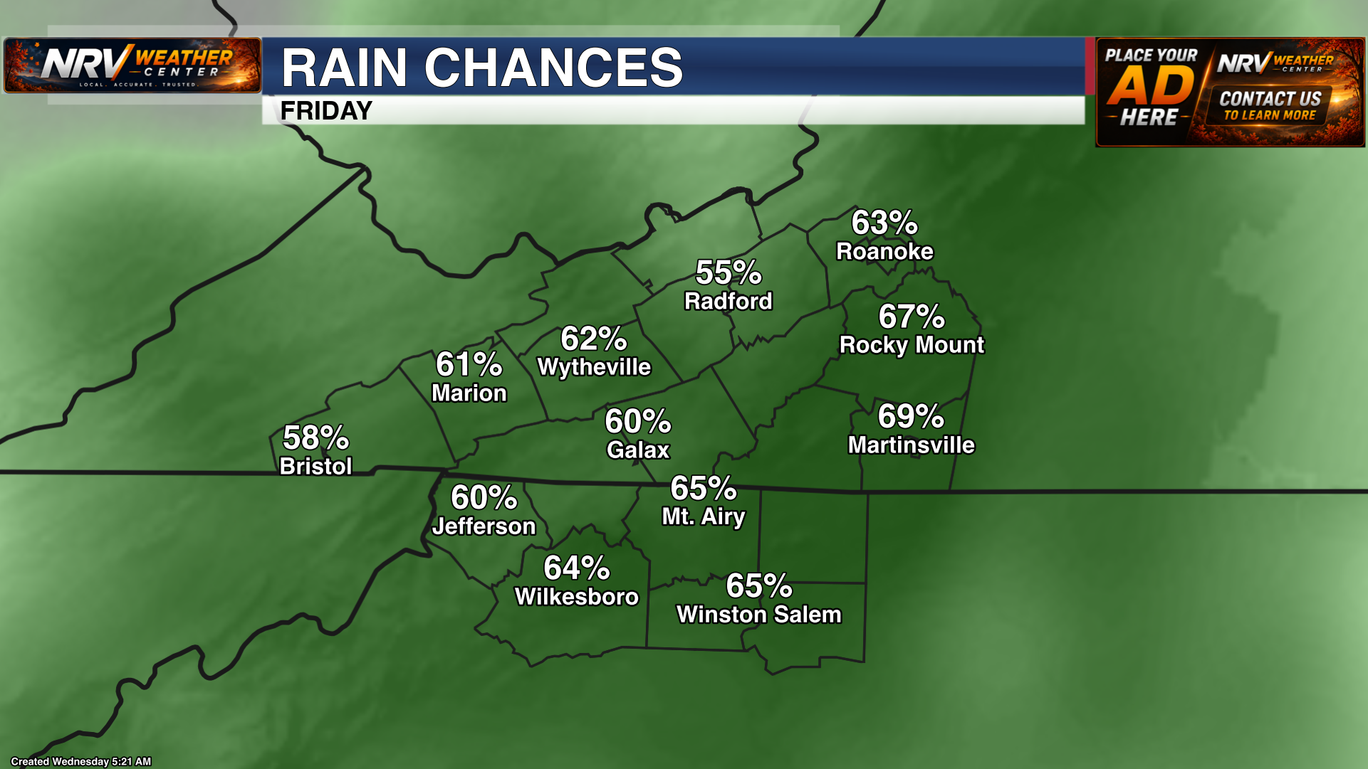
The weather pattern becomes more unsettled Thursday and Friday as moisture increases. Scattered showers and thunderstorms will be possible each day, especially during the afternoon and evening hours.
This does not appear to be a widespread, all-day rain. Rainfall coverage and totals will vary from one community to another, and periods of dry weather are still expected between showers and storms.
At this time, widespread severe weather is not expected, and there are no major flooding concerns. A few storms could still produce brief heavy rain, lightning and gusty winds, so keep an eye on the sky and check the forecast before outdoor activities.
Warmest Thursday and Friday
Thursday and Friday are expected to be the warmest days of the forecast period. Afternoon highs will reach the 80s across much of the region, with some locations climbing into the lower 90s. Increased humidity will also make it feel warmer, particularly during breaks in the clouds.
Rain and Storm Chances Continue This Weekend
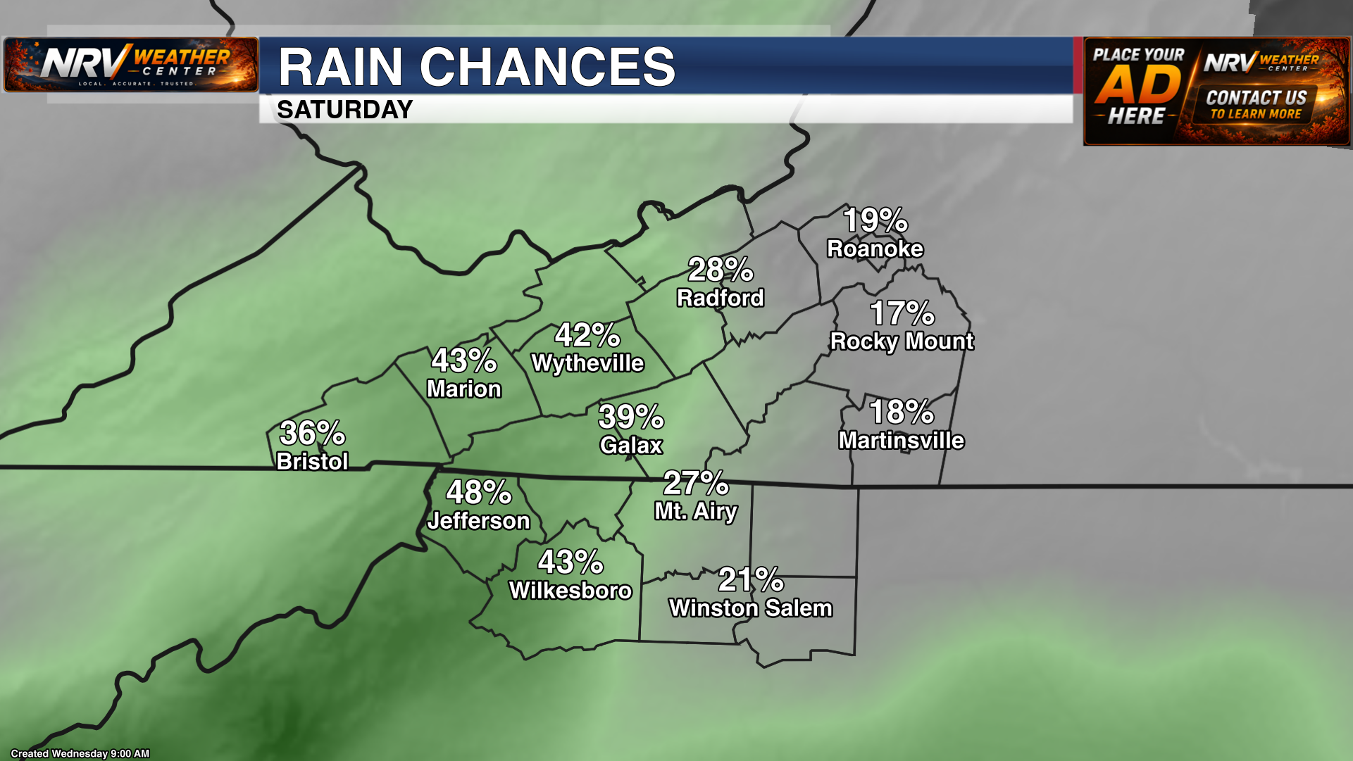
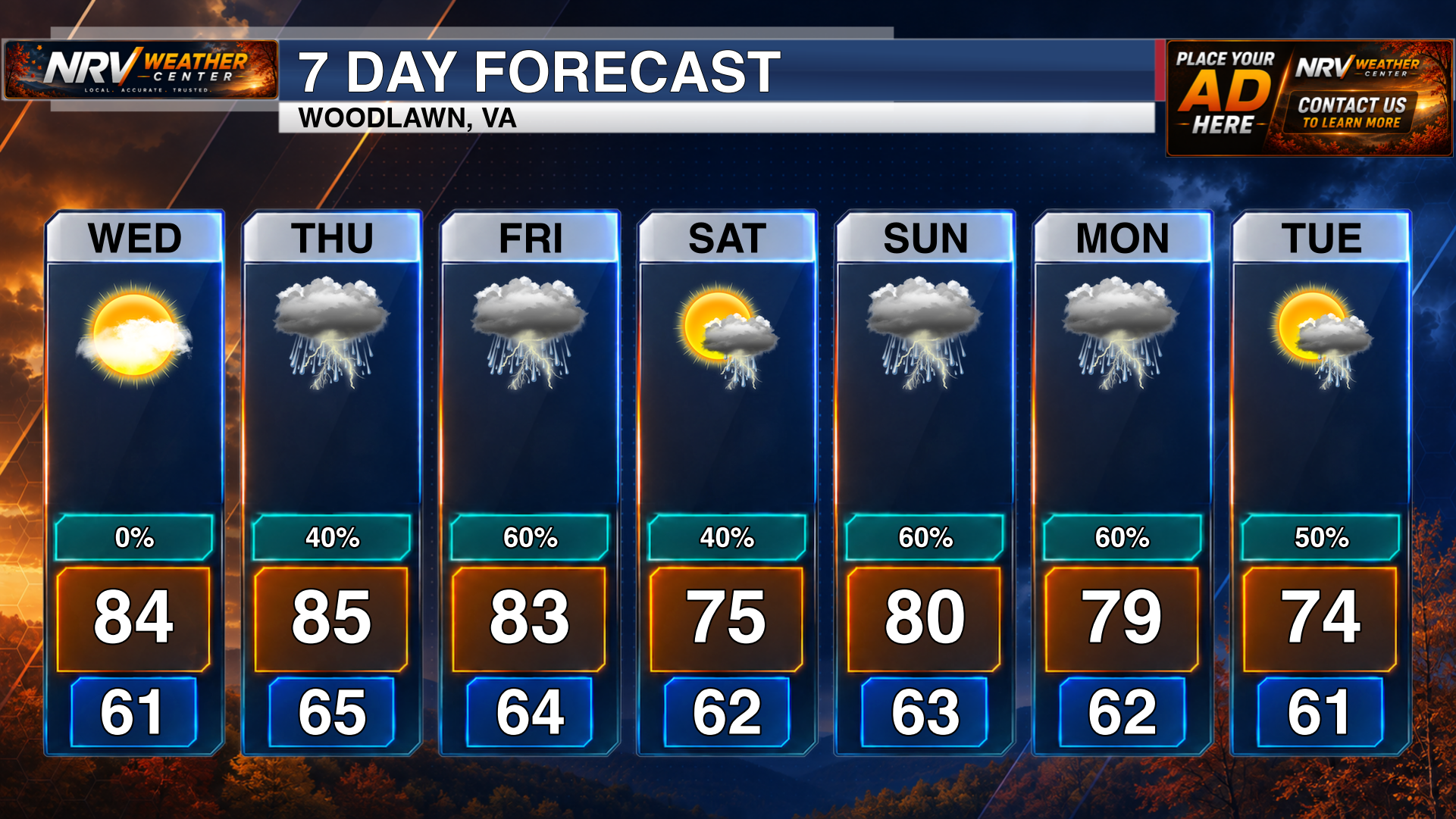
Daily scattered rain and thunderstorm chances will continue into the weekend. The unsettled pattern does not mean it will rain continuously, but anyone with outdoor plans should be prepared for occasional showers or storms and monitor updates as timing becomes clearer.
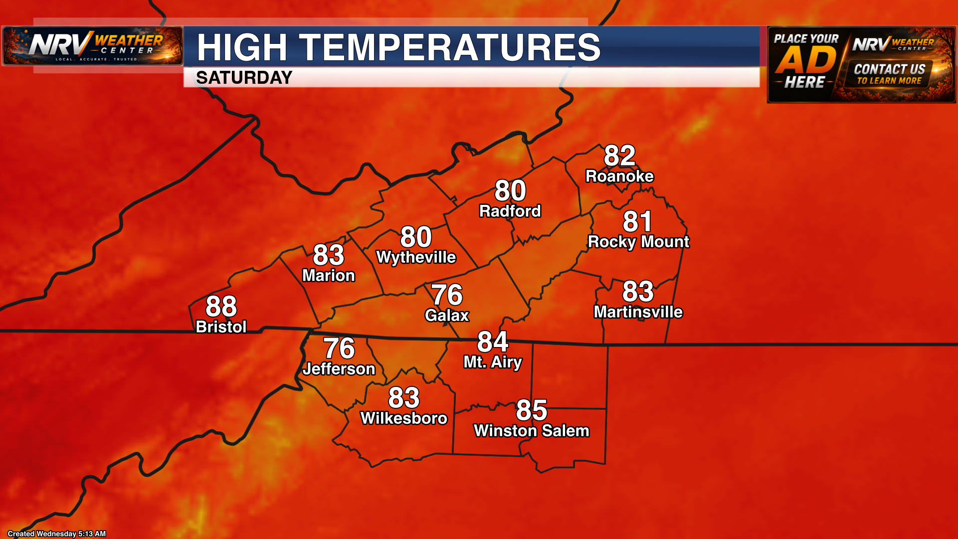
Temperatures will ease back by a few degrees this weekend as clouds and rain chances remain elevated. It will still feel seasonably warm and somewhat humid, but most locations should be a little cooler than Thursday and Friday.
Key Messages
- Sunny, warm and dry weather continues today.
- Scattered showers and thunderstorms return Thursday and remain possible each day through the weekend.
- Thursday and Friday will be the warmest days, with highs in the 80s and lower 90s.
- Widespread severe weather is not expected, and there are no major flooding concerns at this time.
- Temperatures turn a few degrees cooler this weekend while rain chances remain elevated.
Follow NRV Weather Center on Facebook and visit www.nrvweather.com for the latest local weather information.