The first week of meteorological fall will feel much more like the middle of summer. Heat and humidity will continue building across the region through Thursday, followed by an increasing chance for strong to severe thunderstorms Friday. A cooler and more unsettled pattern should gradually arrive late in the weekend.
Heat Builds Through Tuesday
High temperatures Tuesday will reach the upper 80s and low to mid 90s across much of the region. When the humidity is factored in, heat index values will climb into the mid and upper 90s for many communities.
Anyone spending time outside should take frequent breaks, drink plenty of water and avoid strenuous activity during the hottest part of the afternoon when possible. Never leave children or pets inside a parked vehicle.
Triple-Digit Heat Index Values Possible Wednesday
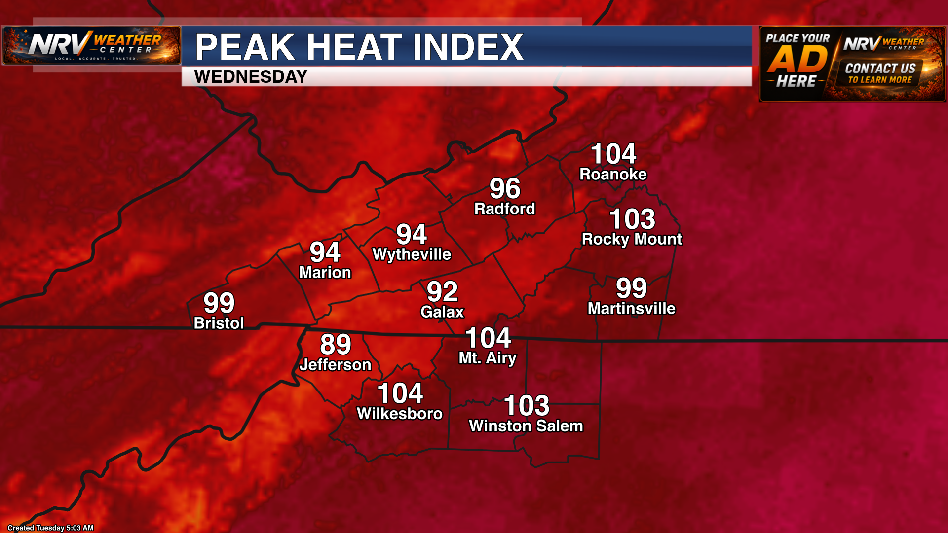
The heat will intensify Wednesday. Actual air temperatures will rise well into the 90s, with a few of the warmest locations approaching 100 degrees.
Heat index values are expected to exceed 100 degrees in areas south and east of the mountains, including portions of the Roanoke Valley, Southside Virginia and the North Carolina Piedmont. Even where the heat index remains below 100, prolonged exposure to the heat may become dangerous.
Thursday Looks Like the Hottest Day
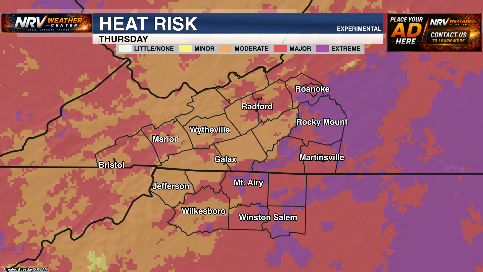
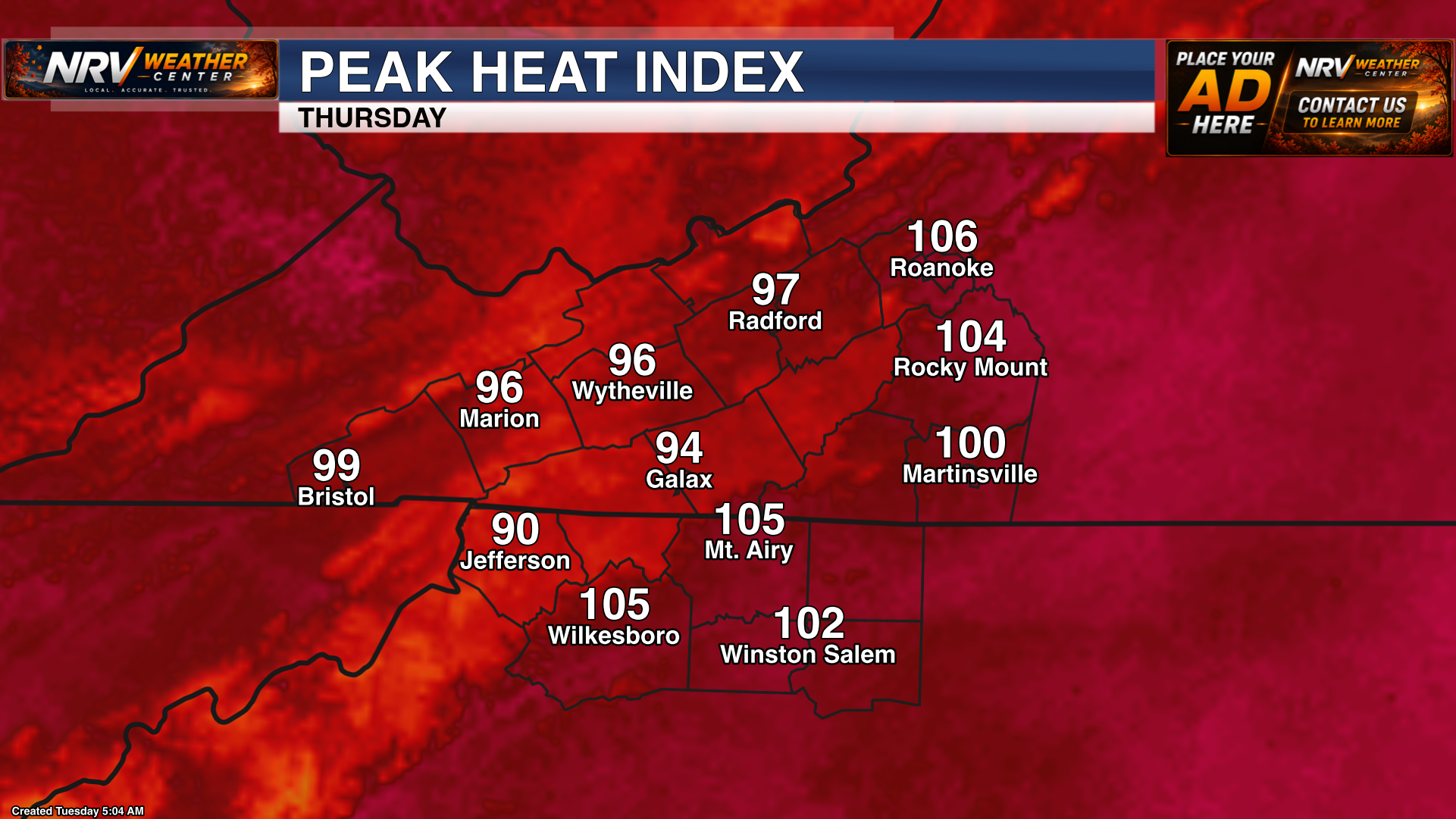
Thursday currently appears to be the hottest day in this forecast period. Heat index values may peak near 106 degrees in Roanoke, with widespread triple-digit readings possible south and east of the Blue Ridge.
Heat Advisories or other extreme heat alerts may be issued as confidence increases. Be sure to check back with NRV Weather Center for the latest forecast and any alerts that are posted.
An isolated thunderstorm may also develop Thursday afternoon or evening. Most locations should remain dry, but any storm that forms could become strong or severe, with gusty or damaging winds the main concern.
Severe Storm Threat Increases Friday
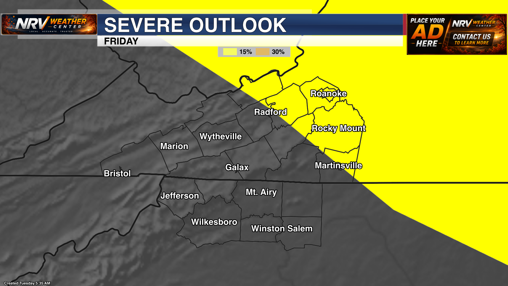
The Storm Prediction Center is already highlighting part of the region for an increased risk of severe thunderstorms Friday. The exact timing and coverage will become clearer over the next few forecast updates, but damaging wind gusts would likely be the primary concern with the strongest storms.
This remains several days away, so changes to the outlook are possible. We will continue watching the timing of any approaching front and how much instability develops ahead of it.
Cooler, More Unsettled Weather Arrives This Weekend
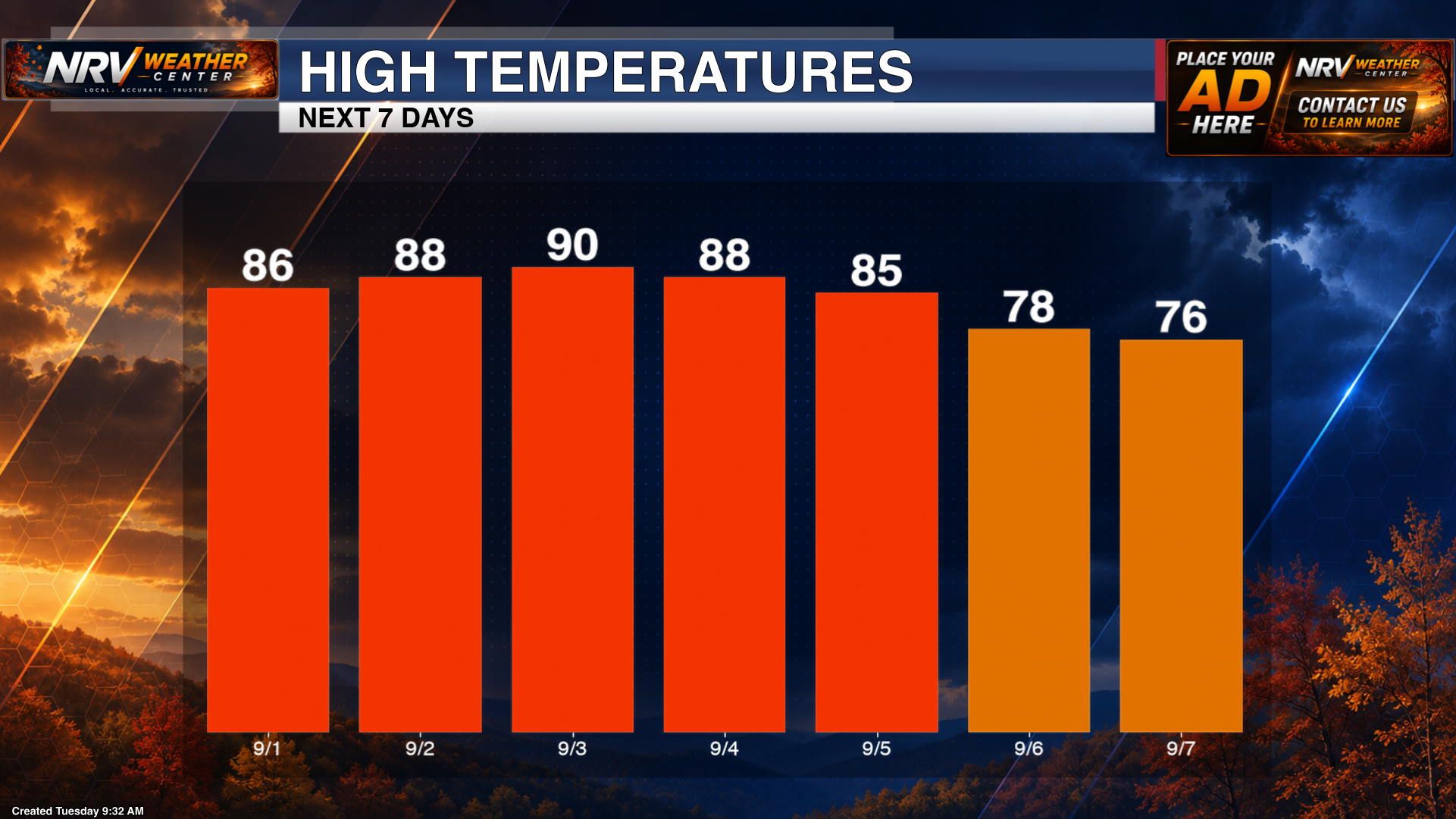
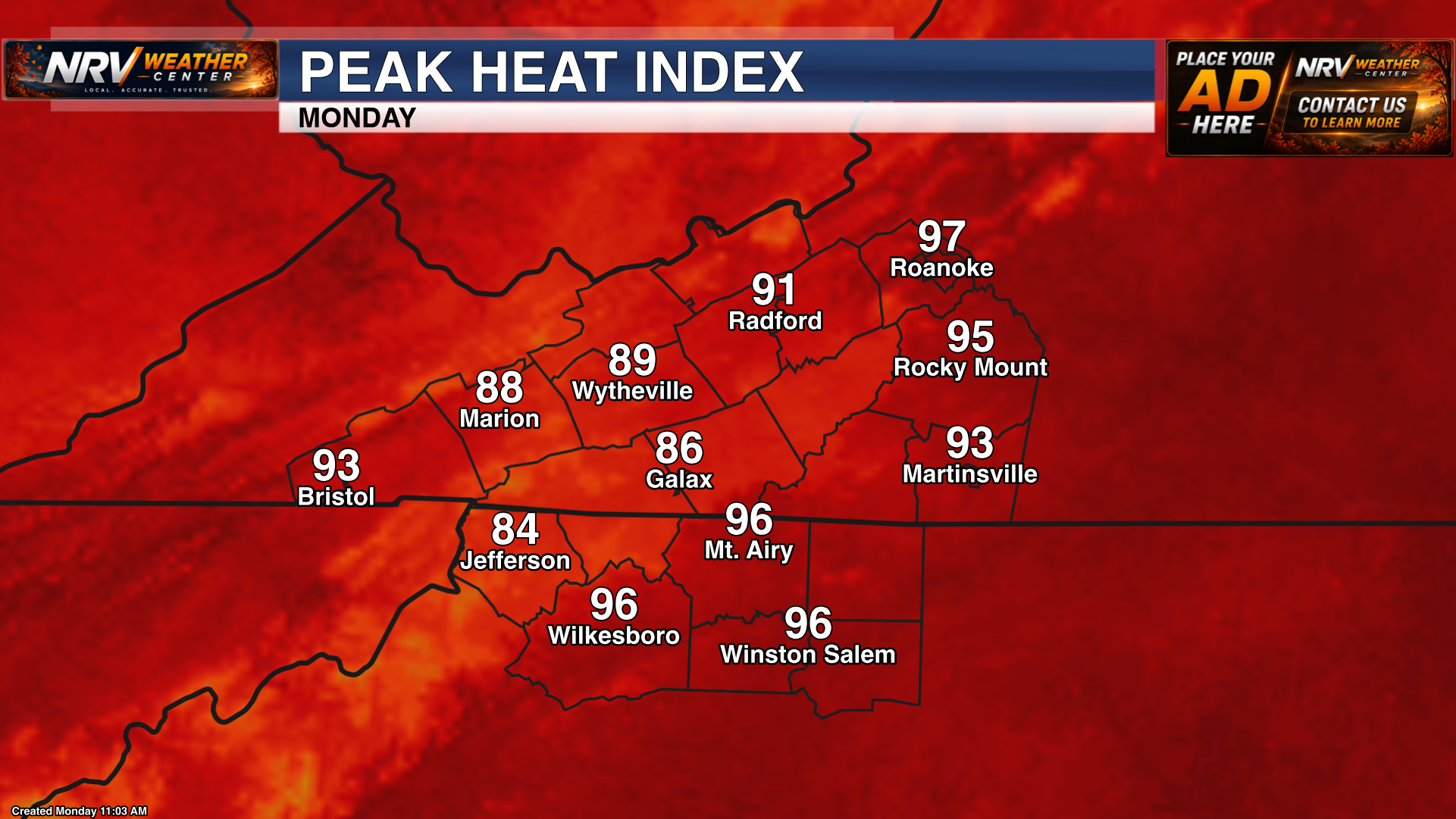
Saturday still looks hot, although shower and thunderstorm chances may become more scattered across the region. A more noticeable change should arrive Sunday and Monday, with highs cooling into the 70s and 80s.
The tradeoff will be a more unsettled pattern, with periodic shower and thunderstorm chances continuing into early next week.
Brief Tropical Update: Tropical Storm Edouard
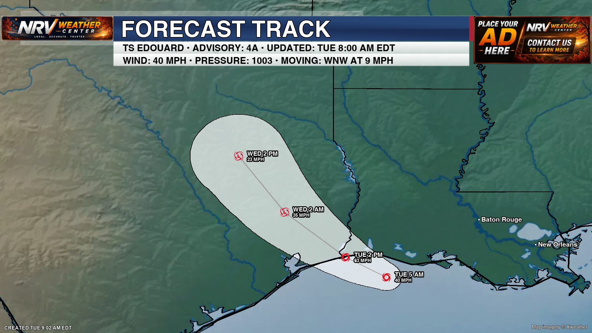
Tropical Storm Edouard is expected to make landfall near the Louisiana–Texas border later Tuesday. Heavy rain, gusty winds and localized flooding will be possible near and east of the storm's path as it moves inland.
Edouard is not expected to directly affect our coverage area, but moisture associated with the system may eventually become part of the broader unsettled pattern later this week.
Continue checking NRV Weather Center for updates on the dangerous heat, late-week storm chances and any watches or warnings issued across the region.