Heat Begins Building Monday
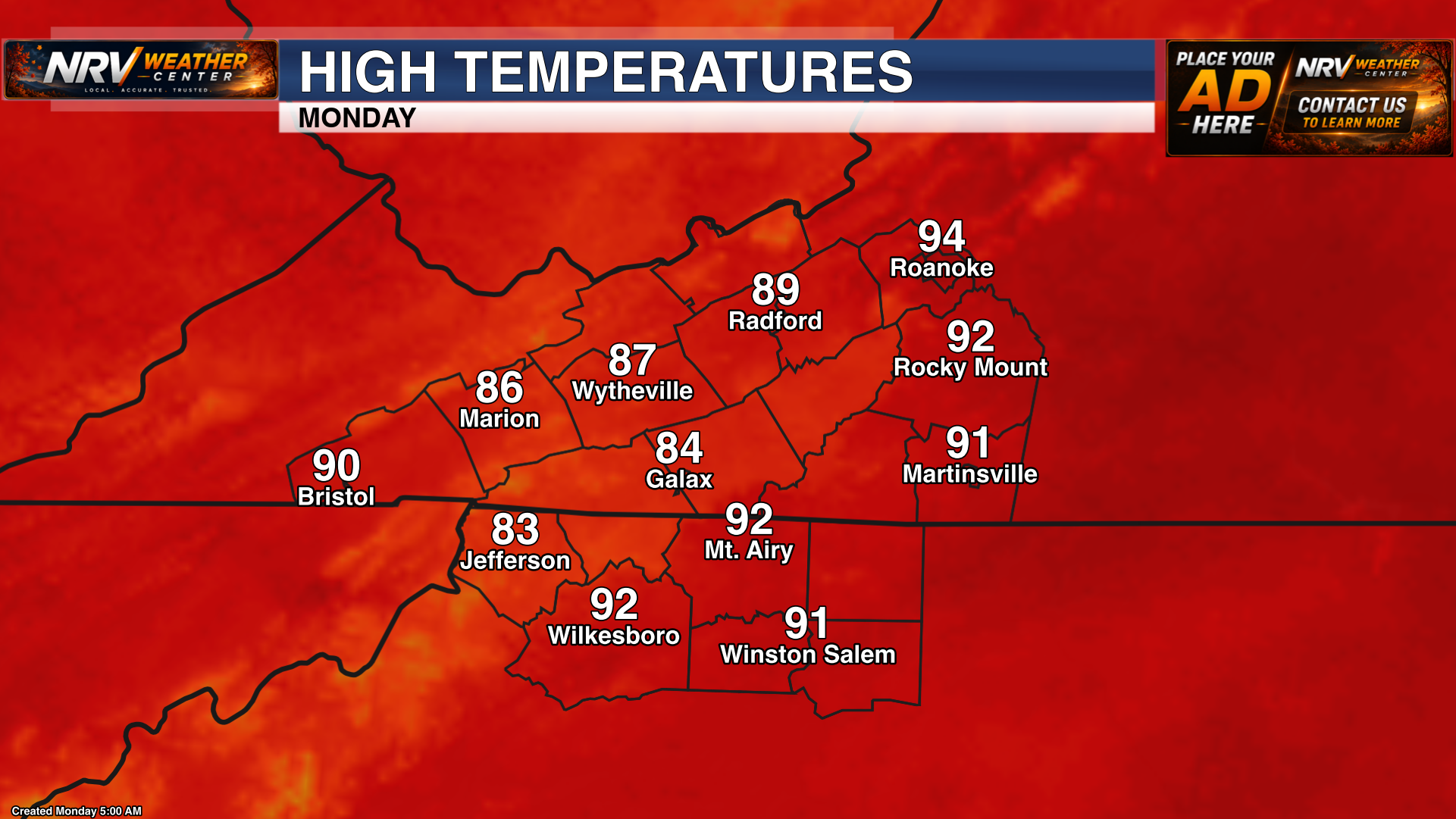
A prolonged stretch of hot weather begins Monday across Southwest Virginia and northwestern North Carolina. Temperatures will climb above what we have experienced recently, marking the beginning of several increasingly hot afternoons.
The greatest heat will generally be found across the lower elevations and east of the Blue Ridge, including portions of the Roanoke Valley, Southside Virginia, the North Carolina foothills and the Piedmont. Mountain communities will also turn hotter, although temperatures there should remain somewhat lower.
Temperatures Continue Climbing Tuesday
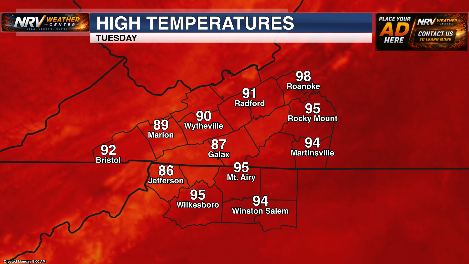
The heat will become more noticeable Tuesday as temperatures and humidity continue to increase. Afternoon conditions will become increasingly uncomfortable, especially for anyone working, exercising or spending an extended amount of time outdoors.
Tuesday will be an important preparation day ahead of the expected peak of the heat on Wednesday. Consider adjusting outdoor plans, checking air-conditioning systems and making sure plenty of water is available.
Heat Peaks Wednesday
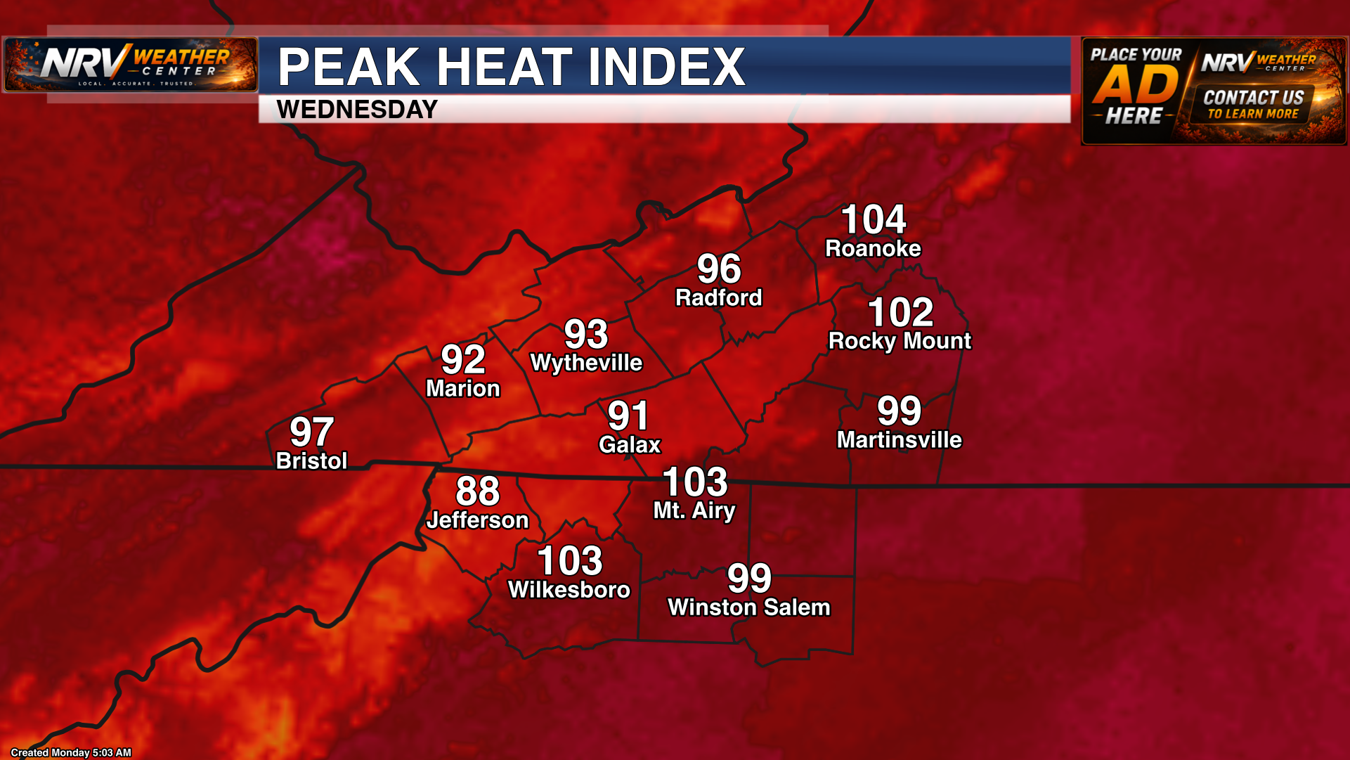
Wednesday is expected to be the hottest and most uncomfortable day of the week. A combination of high temperatures and increasing humidity could push heat index values into the upper 90s, with values near or above 100 degrees possible in some of the warmer communities.
The greatest potential for triple-digit heat index values will be across lower elevations, particularly portions of the Roanoke Valley, Southside Virginia, the North Carolina foothills and the Piedmont.
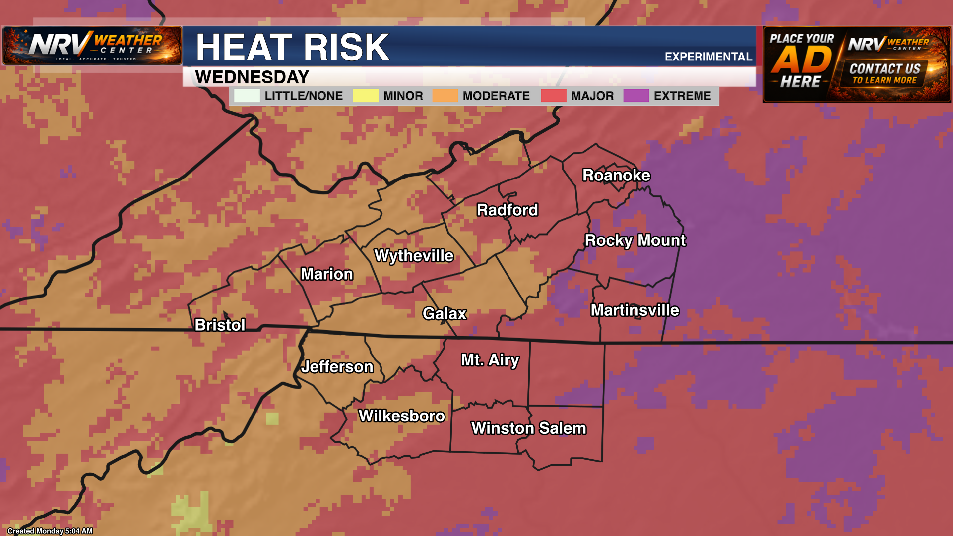
Remember that the heat index represents how hot conditions feel when humidity is combined with the actual air temperature. Even where the heat index remains below 100 degrees, several consecutive days of hot weather can place additional stress on the body.
Heat Safety Is This Week’s Most Important Concern
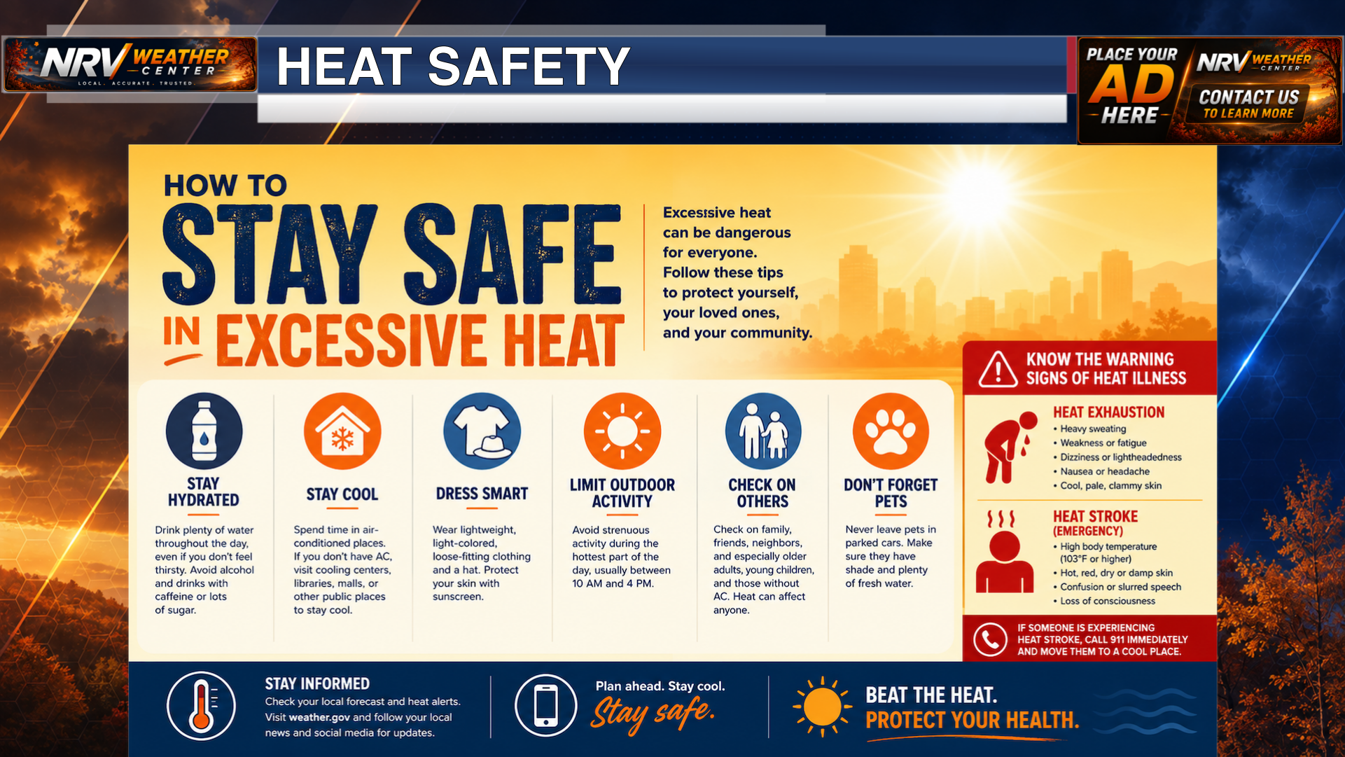
The heat will persist for several days, making heat safety the most important weather concern of the week. Anyone spending time outdoors should take the expected conditions seriously and plan accordingly.
- Drink plenty of water throughout the day, even before you begin feeling thirsty.
- Reduce or reschedule strenuous outdoor activities for the cooler morning or evening hours.
- Take frequent breaks in the shade or an air-conditioned location.
- Wear lightweight, loose-fitting and light-colored clothing.
- Check on older adults, young children and anyone with chronic health conditions.
- Make sure outdoor pets have fresh water and access to shade.
- Never leave children or pets unattended inside a parked vehicle.
Be alert for signs of heat-related illness, including dizziness, nausea, headache, weakness, confusion or unusually heavy sweating. Move anyone experiencing symptoms to a cooler location and seek medical assistance when necessary.
Isolated Storm Chances Return Thursday and Beyond
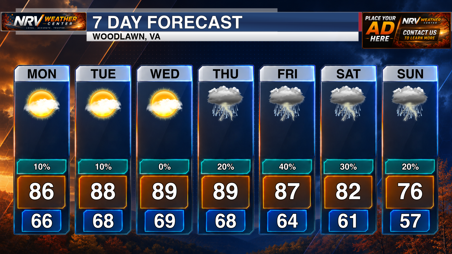
The overall pattern will become slightly more unsettled beginning Thursday, bringing isolated opportunities for showers and thunderstorms through the end of the week.
Rain is not expected to be widespread, and many communities may remain dry on any individual day. However, a passing storm could briefly produce locally heavy rainfall, gusty winds and frequent lightning.
The late-week storm chances may provide temporary relief from the heat in a few locations, but the overall hot and humid pattern is expected to persist. Outdoor plans should continue to account for both the heat and the possibility of an isolated afternoon or evening thunderstorm.
Key Messages
- Heat begins building Monday and persists throughout the week.
- Wednesday is expected to be the hottest day.
- Heat index values near or above 100 degrees are possible Wednesday.
- Heat safety is the most important weather concern this week.
- Isolated shower and thunderstorm chances return Thursday and continue beyond.
Continue following NRV Weather Center for updated temperature, heat-index and rain-chance forecasts throughout the week. Any heat advisories or other weather alerts issued for the region will be available at www.nrvweather.com/alerts.