Updated Wednesday, September 2, 2026, at 9:15 AM
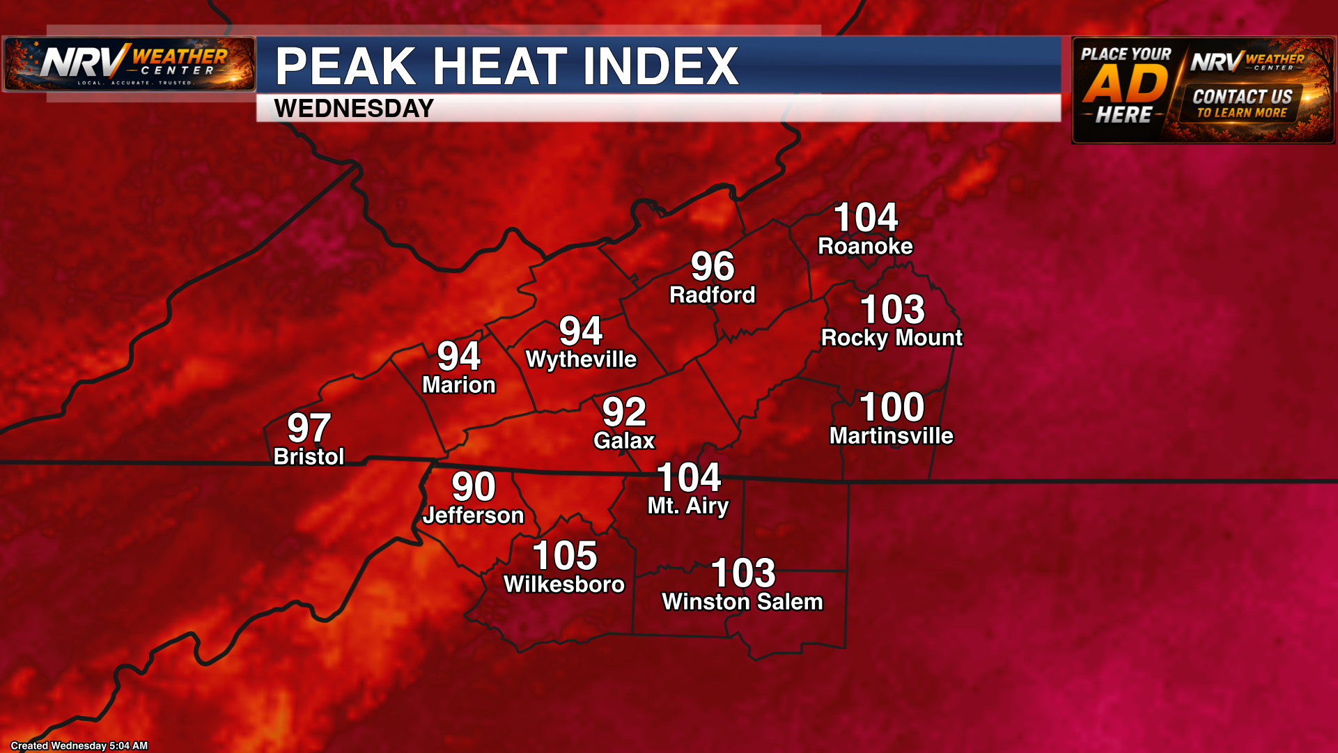
Another hot and humid day is expected across the region today, with afternoon temperatures climbing well into the 90s in many locations. When combined with the high humidity, heat index values will reach or exceed 100 degrees across a large portion of the New River Valley, Roanoke Valley, Southside Virginia, Northern North Carolina, the North Carolina Mountains and the North Carolina Piedmont.
Hottest Weather Expected Thursday
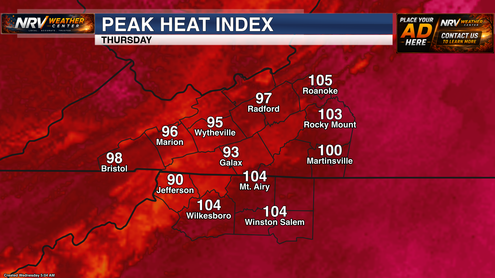
Thursday still appears to be the hottest day of the week. Air temperatures will climb into the 90s across much of the region, and some locations east of the mountains may approach the upper 90s. Widespread heat index values in the triple digits are expected, with the hottest locations potentially feeling like the middle 100s during the afternoon.
The combination of heat and humidity will create an increased risk of heat-related illness. Drink plenty of water, take frequent breaks in the shade or air conditioning, and never leave children or pets inside a parked vehicle. Remember to check on elderly family members, neighbors and anyone without reliable access to air conditioning.
Severe Storm Risk Begins Thursday
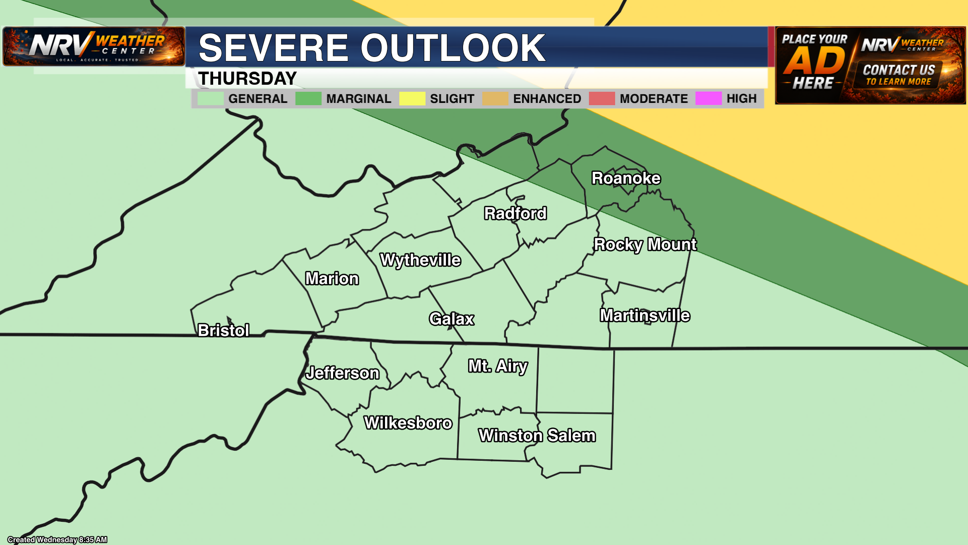
In addition to the dangerous heat, a few thunderstorms may become strong to severe Thursday afternoon and evening. Part of the region is under a Marginal Risk (Level 1 of 5) for severe storms. Storms will likely remain scattered, but any stronger storm could produce damaging wind gusts, frequent lightning and locally heavy rainfall.
Greater Severe Weather Risk Friday
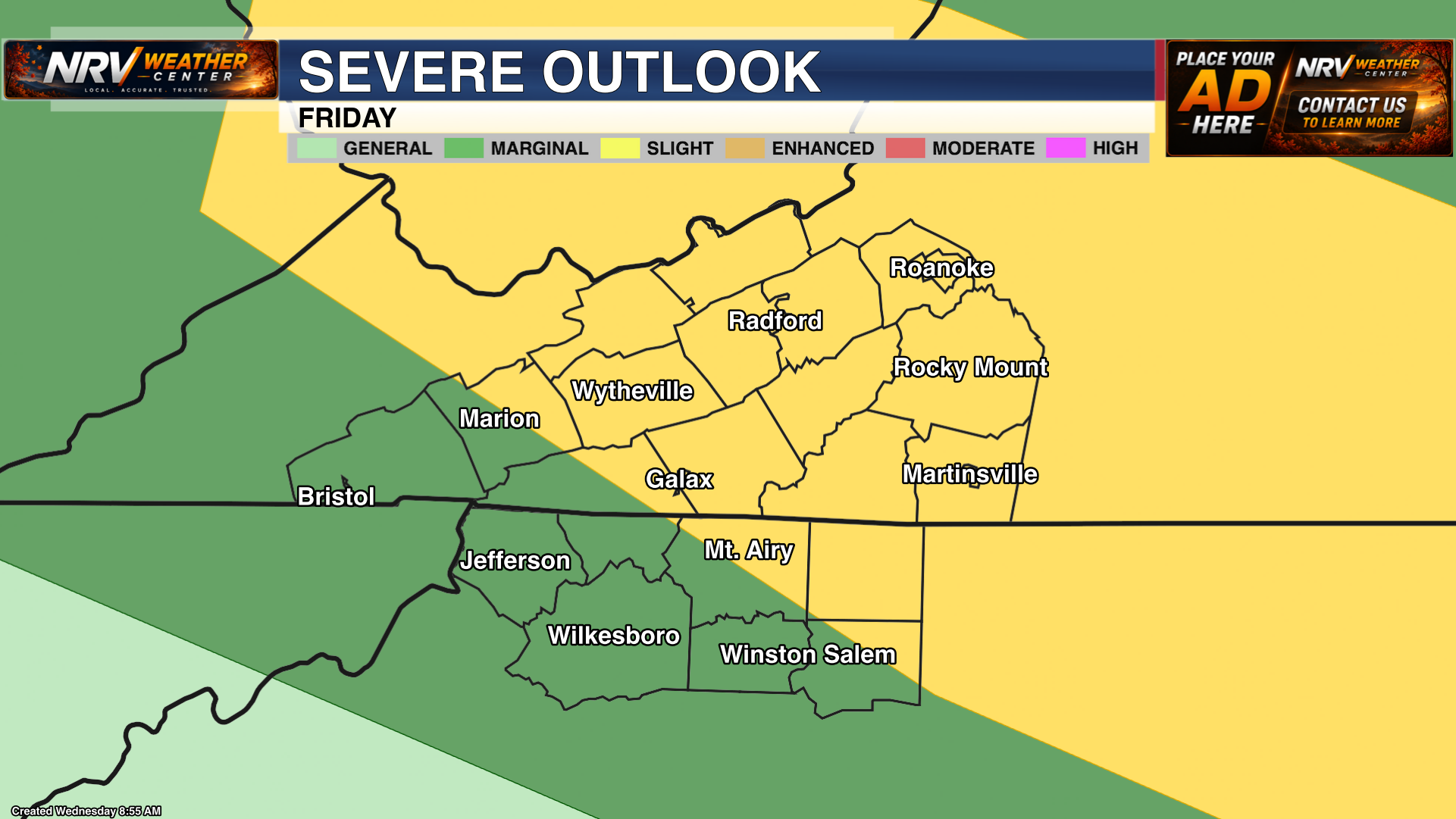
Storm coverage is expected to increase Friday as a weather system approaches the region. Most of the area is under a Slight Risk (Level 2 of 5) for severe storms. This means scattered severe storms will be possible, with damaging wind gusts expected to be the primary concern.
Friday will remain very warm and humid before storms arrive, and triple-digit heat index values will remain possible in many locations. The timing and coverage of storms will be refined as newer forecast guidance becomes available.
Storm Risk Continues into Saturday
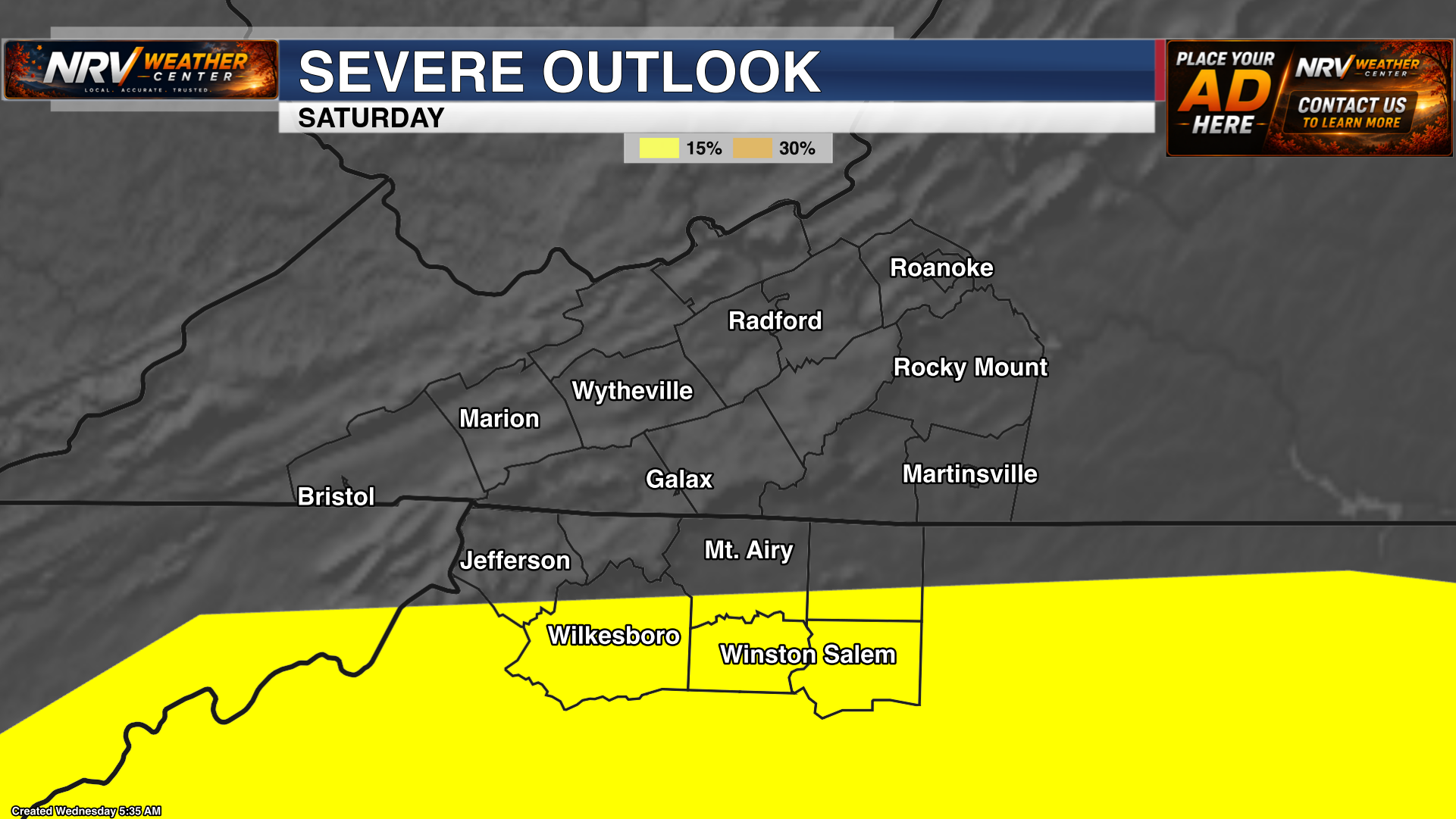
The severe weather threat may shift farther south on Saturday, with portions of our North Carolina coverage area under a Slight Risk (Level 2 of 5). Additional showers and thunderstorms will remain possible elsewhere, although the exact placement and intensity of the strongest storms may change over the next few forecast updates.
Cooler Air Arrives Next Week
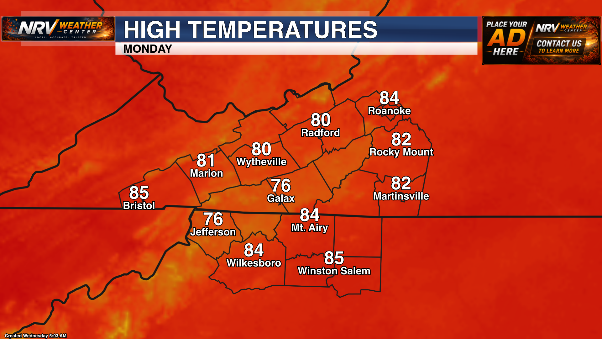
The hot pattern will finally begin to break this weekend. Cooler and more comfortable weather is expected to return by Sunday and especially for the beginning of the work week next week. Afternoon temperatures should fall back into the 70s and 80s across much of the region, providing welcome relief from the heat.
Continue checking NRV Weather Center for updates on heat alerts, storm timing and any changes to the severe weather outlooks through the end of the week.